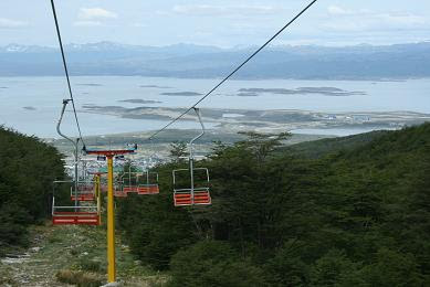
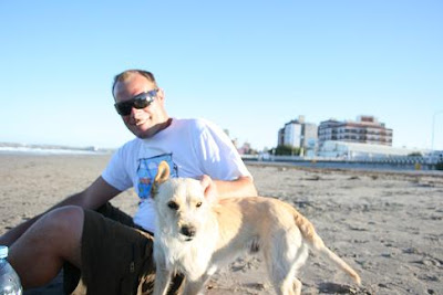
Steve and I flew from Buenos Aires to El Calafate as it avoided the alternative which was to sit on a bus for most of the rest of the Argentinian holiday. It also happened to be a (surprisingly rare) reasonable air fare, and El Calafate is the perfect place from which to visit easily the most notable attraction in the area - the Perito Moreno Glacier.
The flight was 3 hours, and covered probably only 60 - 70% of the length of the country, proving just how vast it is. The land below is almost entirely devoid of interest - it is barely farmed, has little in the way of significant flora on it, and it is hard to work out exactly what its inherent worth is, in dollars (or even cents...).
El Calafate is a significant tourist town built entirely to service the aforementioned attraction. It has a busy high season, running from October to April, and the town swells significantly with tourists and seasonal workers. Outside this time it is reduced to a small number of permanent residents, keen enough to brave the harsh winter here.
It is situated near the shores of Lago Argentina - the largest lake in the country, and, we are told, the third largest in South America. But after being told Aconcagua is the third highest mountain in the world, well, anything is presumably possible.
It is really windy here - comparisons with Wellington are not difficult to find - and I take the opportunity of this ´homely´feel to get out for a decent run. I head around the ´lagoon´which is more like a mini-lake, or even a wetlands, and this area apparently freezes in winter and is used for ice skating.
It supports lots of aquatic birds, and the grasses and tundras are multicoloured, making for a great view as I get 90 minutes of jogging under my belt. The picture, snatched from a bus the next day - apologies for the blurriness (¨no discernable difference from your other photos¨I hear you say). Lago Argentina is the darker strip in the background.
In the morning we boarded the bus for the two hour journey to the glacier, in the Parque Nacional de los Glaciares. I am sure your Spanish is sturdy enough to do the translation. The first part of the glacier we see is the south face, which is far smaller than the north face (that the faces are at 90 degrees to one another makes the names a tad curious, but that´s by the by).

We then board a catamaran for a one hour cruise which gets us up (relatively) close and (relatively)personal with the north face. This is truly awe inspiring, at 5 kilometres wide, and 60 metres high. Being told these statistics we are slightly sceptical (especially about the height), and we are positively certain we are nothing like the 300 metres away from it that we are told. However, later in the day when we see another boat, from a different viewpoint, we know that is one of these great optical illusions - something that your eyes and brain have not had to compute before, and they indeed have played tricks on you.


The reason the boat has to stay 300 metres away, at a minimum, is because of the large impact waves caused by the ice collapses. These are large events, and happen every 30 - 60 minutes. Even ´small´ emounts of ice, seemingly the size of a football (or smaller) make a hell of a racket, and are testament once again to how it is difficult to comprehend the scale of what you are seeing.
The reason that the collapses are quite frequent is because the glacier is quite ´unstable´, meaning that is neither in state of permanent advance, or recession. Rather, it advances 2 metres each day, but it also loses 2 metres a day in terms of collapses, melting, and evaporation. It all makes for a great spectacle - nice work if you can get it, in a glacial sense.
The following picture is taken from a viewpoint later in the day and shows around half of the north face, with a slushy area in front where the ice has collapsed.
This is a view straight up the glacier. At the top it merges into the top of many other glaciers in the area called the Patagonian ice field. Here there is a low-ish gap in the Andes, meaning that rain gets a chance to sneak through the divide, from the west, as snow. This is the reason this particular part of the Andes is so glacier- rich.
It is mesmerising to stand anywhere on the multitude of fantastic walkways and viewpoints that have been created, and to watch for the next collapse. It is even possible to predict what might go next, and in the interim it is amazing to listen to the groaning and creaking of the glacier as it works its way along its course.
The ice itself has many interesting colours - varying from pure white, to grey, through to a beautiful cerulean blue (a la M3). Its structure is also varied - some of it huge pinnacles dozens of metres high, many gigantic crevasses, and an area seemingly with much less snow, just behind the main face. Tourists mid next year might feel a little hard done by. Some of the more central parts of the glacier look as though they have been created by the world´s most pedantic meringue maker.
Finally, a view from near the south face, looking back out toward the north face (the face you can see is essentially a small eastern face). The lake in view is Lago Argentina, and this is one if its many arms in this region. Behind the photographer, if you will, is another lake, which is fed by the southern face of the glacier, and a river running into it 30 kilometres away. This lake drains in to Lago Argentina via the small channel in the front of the picture.
.

Every few years, the channel you see gets blocked by the glacier advancing, and it causes the water level in the lake behind it to rise and rise and rise, until eventually the glacier/dam collapses under the weight of the water. These events are apparently truly spectacular, and would be incredible to witness.
All in all these has been a special day, and something I´d quite happily repeat. I have always wanted to see ice collapsing in great chunks ("calving" as it is termed), and it was a thrill to finally see it. I guess there are chances of seeing similar in Antarctica, though with the ice there being (more) stable it may be wishful thinking.
The next day we leave El Calafate at midday for the 4 hour bus journey to Rio Gallegos. The road climbs up to a plateau and we are right at the back of the bus so we get a good view of the lake and mountains in the distance.
Once up on the plateau the distances are vast, and it continues to look like fairly unproductive sort of land (think Tarras). The area is clearly farmed, however, with well maintained fences running for hundreds of kilometres alongside the road. About all that is missing is livestock - this place certainly has an extraordinarily high fencepost to livestock ratio. The only animals that we do see (aside from the rhea, which is a mini-ostrich - no photo sorry) are farm horses. Presumably these horses are specially trained to round up the little known species - the invisible Patagonian sheep, and the invisible Patagonian cow.

We arrive in Rio Gallegos late afternoon, and check in to a small businessmanish hotel. This place is not on the tourist map, despite being a clear staging post for the last leg down to Ushuaia. The logistics for a straight-through journey are challenging, and it seems to make sense to put the feet up for a night.
Steve and I grab a haircut (I have to demand a No.1 as the barber is incredibly reluctant to sink below a No. 2 and seems genuinely worried that the language barrier is making me ask for the wrong thing), I take a run along the banks of the very wide river, and at dinner we watch the world´s most harassed waiter in action -serving an entire restaurant while two other (younger) staff members sit idly around. Tomorrow we head for the southermost city in the world.


